Map observed water precisely
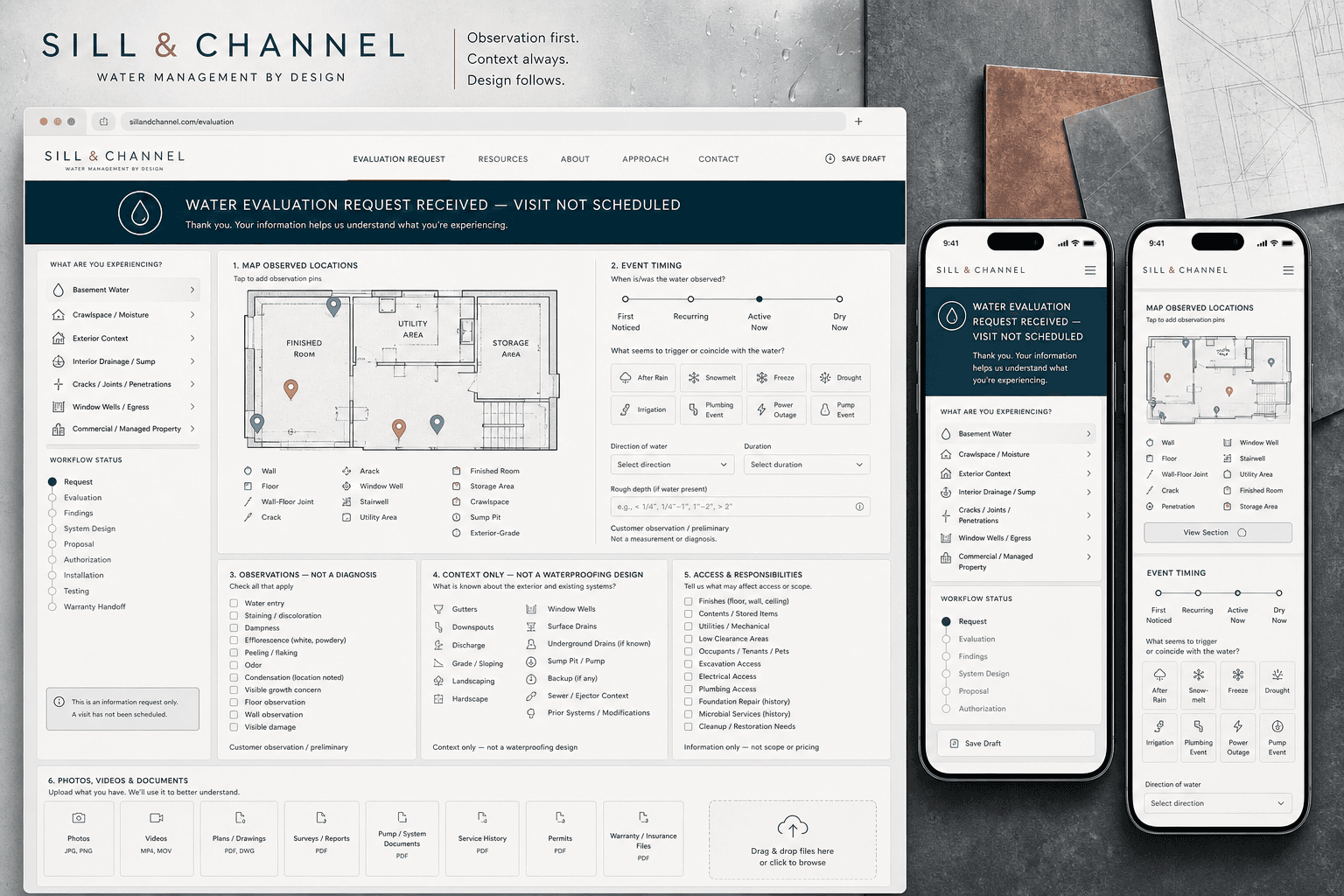
A basement plan and section locate wall, floor, joint, crack, penetration, window well, stairwell, utility, finished, storage, crawlspace, sump, and exterior-grade observations without identifying source.
Fictional concept · Design study
An original responsive evaluation-request direction that organizes observed water locations, event timing, preliminary customer context, existing systems, access, responsibilities, and documents before a visit.
Sill & Channel is a fictional brand created by BLUEROCK. This is not client work. The property, diagrams, observations, measurements, systems, interface, records, wording, and states are illustrative design material—not a real company, customer, building, water event, evaluation, design, or project. Nothing shown establishes water source, cause, pressure, structural or microbial condition, health risk, actual measurements, drainage or waterproofing design, product selection, pump specification, performance, coverage, warranty, license, insurance, price, scheduled visit, findings, approved scope, installation, testing, permanently dry condition, guarantee, or business outcome.
Design question
The concept makes location, timing, current state, exterior and existing-system context, access, responsibilities, and records legible while reserving investigation, findings, design, product, price, performance, and authorization for qualified workflows.
A basement plan and section locate wall, floor, joint, crack, penetration, window well, stairwell, utility, finished, storage, crawlspace, sump, and exterior-grade observations without identifying source.
First noticed, recurring, active or dry now, rain, snowmelt, freeze, drought, irrigation, plumbing, power, and pump events create a useful timeline without proving causation.
Direction, duration, rough depth, staining, dampness, efflorescence, peeling, odor, condensation location, visible growth concern, and visible damage remain customer-reported context—not diagnosis.
Gutters, downspouts, discharge, grade, landscape, hardscape, wells, drains as known, sump, backup, sewer or ejector context, and prior modifications can be documented without recommending a system.
Finishes, contents, utilities, clearance, occupants, excavation, electrical, plumbing, foundation repair, microbial history, cleanup, and restoration boundaries sit beside photos and videos.
Plans, surveys, reports, pump or system documents, service history, permits, warranty, and insurance files can support evaluation without validating their conclusions or coverage.
Interaction architecture
Identify basement water, crawlspace or moisture, exterior context, drainage or sump, crack or penetration, window well, commercial, or another supported path.
Pin where water or moisture was observed and describe timing, conditions, direction, duration, rough depth, and current state.
Record exterior water paths, systems as known, finishes, contents, utilities, occupants, access, prior work, and responsibility boundaries.
Upload photos, video, plans, surveys, reports, equipment documents, history, permits, warranty, and insurance files.
Submit information without manufacturing source, diagnosis, findings, system design, price, appointment, authorization, or performance promise.
The real responsible parties coordinate evaluation, further investigation, findings, system design where qualified, proposal, permits, trades, authorization, installation, testing, and warranty handoff.
From concept to production
A production site should reflect actual evaluation and investigation practices, supported systems, professional and trade boundaries, products, warranties, maintenance, service territory, scheduling, and approved project evidence.
See the BLUEROCK approach to calm water documentation, verified systems, explicit responsibilities, qualified evaluation, and honest request states.
Explore Basement Waterproofing Web Design