Route by project type
Site preparation, foundations, trenching, utilities, septic, drainage, clearing, demolition, roads, driveways, and commercial bids begin with different information paths.
Fictional concept · Design study
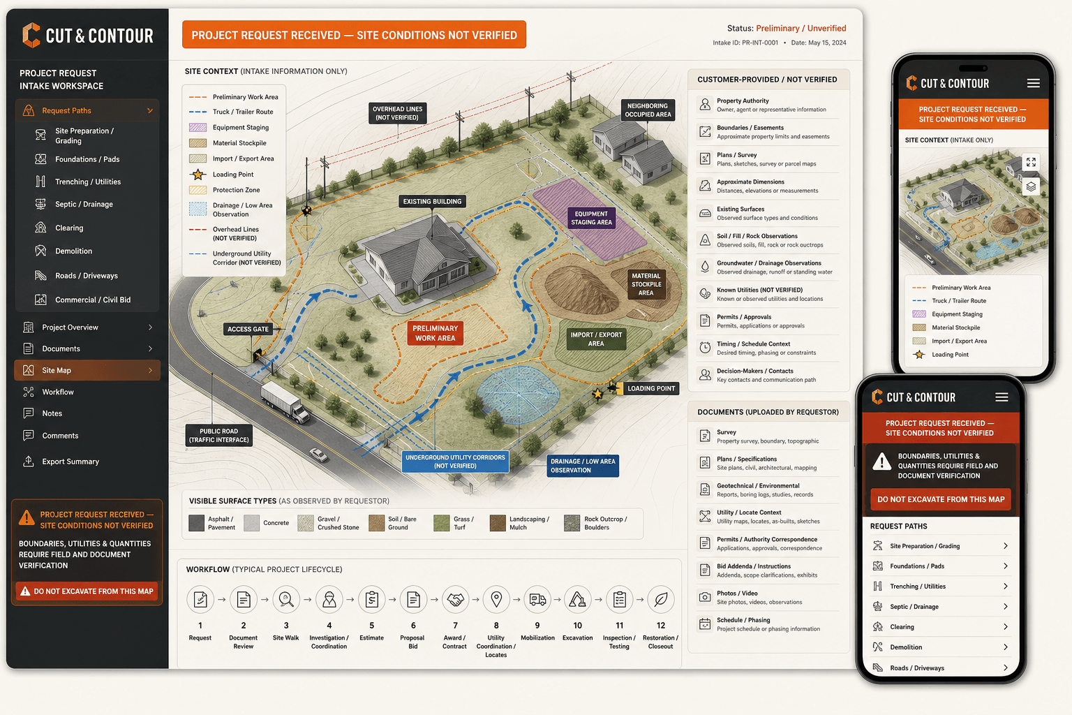
An original responsive project-request direction that organizes site intent, preliminary logistics, access, observed conditions, utilities as known, documents, and project states before a site walk.
Cut & Contour is a fictional brand created by BLUEROCK. This is not client work. The company, requester, property, buildings, map, boundaries, easements, utilities, surfaces, dimensions, soil, rock, groundwater, drainage, work area, routes, equipment, quantities, documents, interface, and states are illustrative. Nothing shown is a survey, utility locate, geotechnical or environmental conclusion, engineering or excavation plan, traffic plan, safety clearance, authority approval, permit, estimate, bid, contract, award, schedule, mobilization, inspection, test, completed work, restoration, license, insurance, warranty, guarantee, or business outcome.
Design question
The concept makes logistics, observations, documents, unknowns, and project states legible while reserving boundaries, utilities, investigation, engineering, estimating, authorization, execution, and safety for responsible field and document workflows.
Site preparation, foundations, trenching, utilities, septic, drainage, clearing, demolition, roads, driveways, and commercial bids begin with different information paths.
A preliminary map locates the intended work area, access, equipment staging, stockpiles, loading, protection, drainage observations, neighbors, surfaces, and road interface without becoming a survey or plan.
Truck and trailer route, gate, road limits, staging, loading, import and export areas, overhead clearance, structures, landscaping, and occupied areas can be reviewed before equipment is assigned.
Customer maps, visible markings, corridors, tickets, surveys, or recollections never become utility clearance, boundary control, excavation authorization, or a safety determination inside the interface.
Survey, plans, geotechnical and environmental records, utility context, permits, correspondence, bid addenda, photos, video, and schedule support qualified review without proving their accuracy or approval.
Site walk, investigation, estimating, award, contract, utility coordination, permits, mobilization, excavation, inspection, testing, restoration, and closeout remain explicit states.
Interaction architecture
Start with site preparation, foundation or pad, trenching, utilities, septic, drainage, clearing, demolition, road, driveway, commercial, civil, or another supported request.
Identify the intended work area, truck route, staging, stockpile, loading, import/export, protection, neighbors, road interface, surfaces, and observed drainage context.
Record authority, boundaries and easements, approximate dimensions, existing conditions, utilities as known, soil or rock observations, groundwater observations, permits, timing, and decision-makers as unverified inputs.
Upload surveys, plans, reports, utility or locate context, permits, correspondence, bid documents, photos, video, and schedules for responsible review.
Confirm receipt without fabricating verified site conditions, utilities, boundaries, quantities, design, price, award, permit, schedule, mobilization, or completed work.
The responsible parties separately complete document review, site walk, investigation, estimating, proposal, award, contract, utility coordination, permits, mobilization, excavation, inspection or testing, restoration, and closeout.
From concept to production
A production site should reflect actual territory, fleet access, qualifications, project capacity, investigation and estimating practices, utility and safety workflows, authority relationships, bid process, mobilization, field documentation, testing, restoration, and approved project evidence.
See the BLUEROCK approach to clear project routing, real work, preliminary site context, verified capabilities, qualified estimating, and honest project status.
Explore Excavation Contractor Web Design